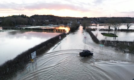
A major incident was declared in Leicestershire after melting snow and rain led to widespread flooding on a “miserable Monday” across the the UK that saw travel chaos, power cuts and school closures.
The Met Office said there was no immediate prospect of a respite in the wintry weather with yellow warnings put in place until Wednesday.
Leicestershire fire and rescue services, which declared the major incident, said crews rescued at least 17 people after more than 200 calls were received on Monday morning.
The incidents involved evacuating people from flooded homes, rising water and cars submerged in flood water.
A Leicestershire restaurant owner was hailed a hero after rescuing a woman from a submerged car.
Footage showed Cimi Kazazi, who owns the Italian Greyhound in Great Glen, wading chest-high through flood water and helping the woman to safety.
By Monday afternoon there were more than 180 flood warnings in place across England, which means flooding is expected, and more than 300 flood alerts, which means flooding is possible.
Judi Beresford, Leicestershire’s assistant chief fire and rescue officer, urged people to take the warnings seriously. She said: “We are working with our partners to reduce the impact of this major incident and ask the public to avoid flooded routes when travelling and never to enter flood water.”
Flooding also caused problems for railway passengers and drivers on roads. The AA labelled it “miserable Monday” and the RAC said it expected its busiest day of the winter, dealing with 20 breakdowns a minute at the peak.
Road closures on Monday included the M5 southbound in Gloucestershire, because of extensive flooding; the A66 across the Pennines from North Yorkshire to Cumbria because of snow; and the A46 in Warwickshire after an accident.
There was also delays on the M25 when a section was closed from junction 10 to 8 after a lorry accident, affecting many people travelling to Gatwick airport.
Rail lines between Derby and Nottingham were closed due to flooding affecting CrossCountry and East Midlands Railway services. Many trains across the network, including those between Gloucester and Bristol, were running at a reduced speed.
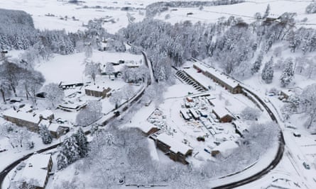
Manchester airport’s runways were closed early on Monday morning because of heavy snow but later reopened. Three departures were cancelled and a number of other flights were delayed.
More than 27,000 homes and businesses across Yorkshire and the north-east of England lost power during the cold snap, network operators Northern Powergrid said.
The firm said its teams “worked around the clock” to restore electricity supplies to all but about 100 customers by Monday lunchtime.
The Met Office said it was Britain’s coldest night of the winter so far after -13.3C was recorded at Loch Glascarnoch in the Highlands between Ullapool and Inverness.
The return to school was delayed for tens of thousands of children across Britain, with Yorkshire being particularly badly affected. In Bradford, 180 schools were closed, in Leeds more than 100 and there were dozens more shut across Calderdale, Halifax, Kirklees and North Yorkshire.
There were also school closures in Lancashire, Cheshire, County Durham and northern Scotland, with about 80 shut in Aberdeenshire.
After a weekend of extreme weather the Met Office issued new yellow warnings covering large parts of the UK for the coming days.
A warning for snow and ice is in place across most of south-west England and Wales, and parts of north-west England and the West Midlands, until 10am on Tuesday.
The same warning is in place for western and northern parts of Scotland until midday on Tuesday, and in Northern Ireland until 11am.
There is a separate warning for snow in southern England on Wednesday from 9am until 11.59pm.
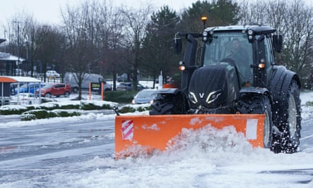
Frank Saunders, Met Office chief meteorologist, said: “Hail, sleet or snow showers are expected to affect parts of Scotland and Northern Ireland, spreading to Wales and parts of north-west England this evening, before moving into part of south-west England, the Midlands and southern England during the early hours of Tuesday. Rain or hail is more likely towards some western coasts.
“Icy stretches which develop overnight as a result of these showers, or the recent wet conditions, could bring some disruption to travel. In addition to the ice, we could see snow accumulations of a few centimetres above 200 metres, with a chance of greater than 5cm above 200 metres in Wales.
“The heaviest snow showers may also produce temporary accumulations of 0-2cm at low levels. It is not possible to say exactly where this snow might fall, so it’s important that people are prepared.”

.png) 3 months ago
30
3 months ago
30


