.png) 2 months ago
60
2 months ago
60
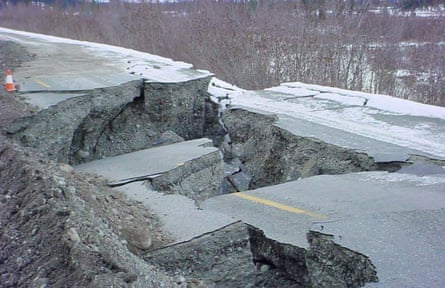
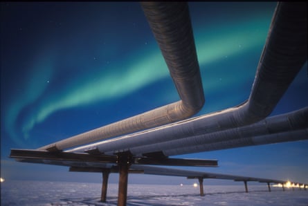
When an earthquake in 2002 struck in a remote pocket of Alaska, the shock was the strongest ever recorded in the interior of the state. But, miraculously, an oil pipeline that crossed directly over the fault line was unscathed.
Engineers behind the design of the 800 mile system were prepared. Knowing the high likelihood of seismic activity along the route, which bisected the Denali fault, they constructed sections where the pipeline rested on rail girders, allowing it to sway and shear without snapping.
“It worked because they could pinpoint how and where to build: they could put their hand right on the fault,” said Edwin Nissen, a seismologist at the University of Victoria. “The problem for Canada is that there’s nothing like that in British Columbia, where a pipeline has been proposed. There’s never been a study as detailed as they one they did for the pipeline in Alaska and as a result, there’s just so much we don’t know.”

Canada’s prime minister Mark Carney has given his government’s blessing to an oil pipeline last week that would cross Alberta and British Columbia and terminate at the Pacific. But amid fierce debate over the political, environmental and economic implications of the project, experts warn that the multibillion-dollar project faces immense – and poorly understood – geological hazards.
While no route for a heavy oil pipeline has been officially proposed, nor has any company stepped forward to build it, the most efficient route from Edmonton, Alberta, would invariably pass through the Rocky Mountain trench and along the sparsely populated north of British Columbia before terminating at the Douglas Channel, a region with a crenulated landscape of deep fjords. The project has already faced strong opposition from First Nations over fears that Carney’s government will lift a five-decade oil tanker ban in the region.
So far much of the public debate has focused on the immense risk of a maritime disaster, but Nissen warns the geography of the landscape itself presents fresh and troubling risks.
Nissen and his research team argue that at least two seismic faults, including the Rocky Mountain trench which most Canadian geologists believe are ‘extinct’ or long dormant, are instead still active and “can host big surface-rupturing earthquakes”. He also says the tectonics in mountainous areas along the Pacific coast are “very poorly understood”.
“This part of the world, where we’re talking about a pipeline, is very poorly instrumented and as a result, we actually know very little about it,” he said. A large earthquake – or even smaller earthquakes triggering landslides – could unleash environmental disaster.
The challenge for Canada is that the vast majority of its seismic monitoring instrumentation is heavily concentrated along the country’s southern border, where the bulk of the population lives.
“In the places where the pipeline might get built, there’s basically no monitoring of earthquakes. There’s no monitoring of landslides. And we don’t have the instrumentation that would actually map out small earthquakes along these faults,” he said. “Science funding in Canada is pretty threadbare compared to America. We don’t have the resources to just go out and deploy seismic stations and GPS stations. It’s expensive business and we don’t have the funds.”
David Eby, British Columbia’s premier, has emerged as a sharp critic of the project, expressing frustration over being excluded from discussions between Ottawa and Alberta even though the route would cross through his province.
“The oil sands in Alberta will get most of the profit from this pipeline, but all of the risk is being placed on British Columbia and particularly the First Nations along the west coast,” said Nissen. “In a way, it feels like the global financial crisis of 2008: the profit was private, the bailouts were for the big bank and the risk was basically subsidized by all taxpayers.”
While risks of building in seismically active areas can be minimized through engineering, that process is “phenomenally expensive” if the “basic science” hasn’t yet been completed.
“What’s going on in these regions? Where are the faults? What is the risk of an earthquake on each of them? These are questions we should ideally be asking – and have answered before the conversation even begins about a pipeline,” he said. “Black swan events are by their nature unlikely, but they’re something we should factor in. Because when these massive landslides and massive earthquakes and tsunamis happen, they often take professionals like myself by surprise.”
In 1958, an earthquake in a remote Alaskan bay triggered a landslide which in turn created a megatsunami, with a wave reaching a height of roughly 553 meters – nearly double the height of The Shard in London.
A wave of such “phenomenally terrifying elevation” was only possible because of the physical geography of fjord, where, unlike in the ocean, the energy could not easily dissipate, said Daniel Shugar, a geomorphologist at the University of Calgary.
The challenge for a pipeline stretching across British Columbia is that the landscape around a possible terminus is eerily similar to that of much of Alaska’s south-eastern coastline, where the Lituya Bay mega-tsunami occurred.
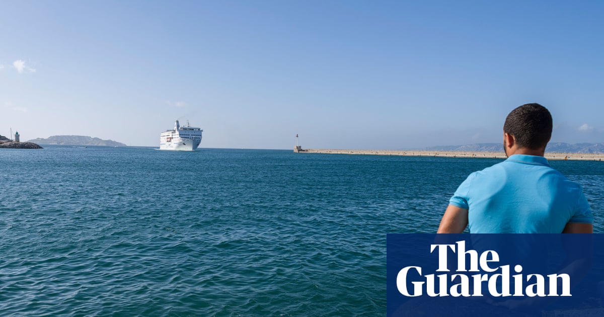
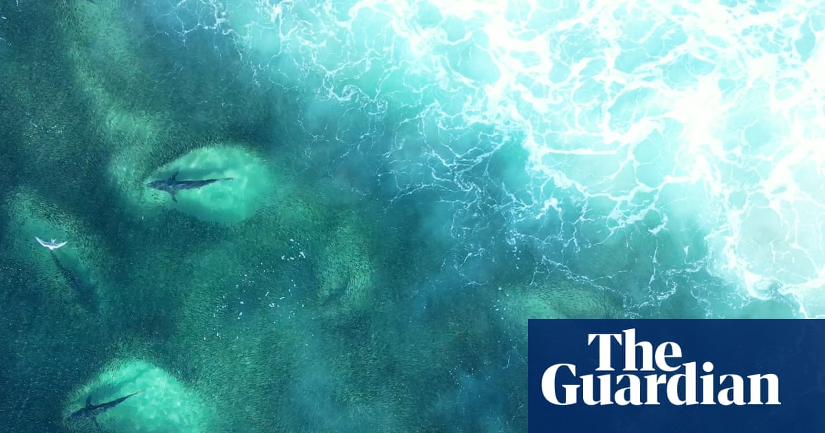
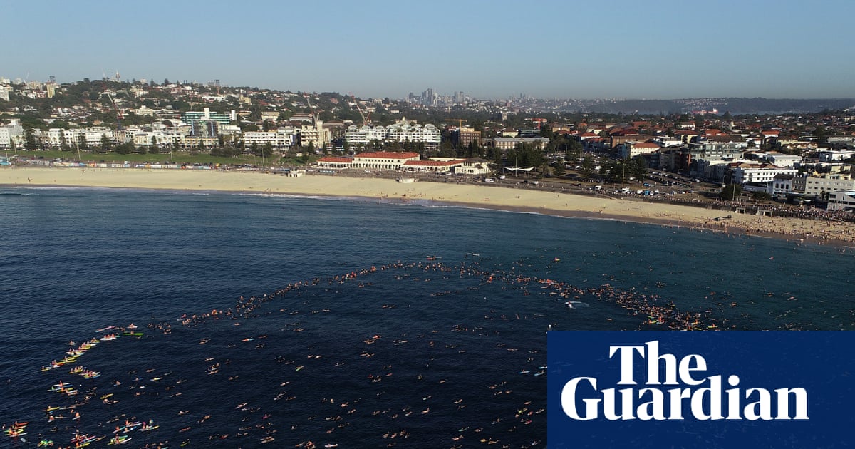
The most likely location for a terminal where large oil tankers could load up with crude oil for transport to Asia is in the Douglas Channel, an increasingly busy shipping route through the fjord.
Canada’s geological survey has recently carried out “superb” high resolution sonar mapping, uncovering roughly 100 past landslides in the Douglas channel, said Shugar. While some were small, a handful were “truly gigantic” and would prove “catastrophic, not only to a tanker, but potentially to any towns or other infrastructure in the fjord”, he said.
While these events are scattered over millions of years, with enough data and time, scientists could calculate a recurrence interval, which gives a rough sense of how often these landslide might occur.
“When we’re designing or making decisions about facilities that have a lifespan of decades we need to be considering the geophysical risks that might exist – even if those risks are relatively small,” he said. He points to Greenland’s government, which recently announced it would “discourage” all marine traffic in a fjord over risks of landslide-created tsunamis.
“We tend not to have a very long view of history. Our politicians tend to think in four-year time frames. But nature doesn’t care about that. Geology certainly doesn’t care about that. And the disasters of the past teach us that ecosystems can take many decades to recover from what might only unfold in a few minutes.”