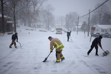
Millions of Americans were hit by a major winter storm on Monday that brought heavy snow, ice, strong winds and freezing temperatures as it moved east out of the center of the country and into the mid-Atlantic region.
The US National Weather Service issued winter storm warnings and advisories stretching from Kansas and Missouri to New Jersey as moderate to heavy snow is expected from the Ohio Valley to the mid-Atlantic region.
A state of emergency has been declared in several states as of Monday morning, including Kansas, Missouri, Maryland, Kentucky, Virginia, West Virginia, Washington DC, Arkansas and parts of New Jersey, with officials urging people to stay home and off the roads.
The storm is projected to produce between six to 12in of snow across the mid-Atlantic region, including the Washington DC metro area, according to the National Weather Service.

The storm hit the midwest region of the US over the weekend, and brought heavy snow and ice to roads in areas including Kansas and Missouri.
On Sunday, Kansas City international airport recorded 11in (27cm) of snow, according to the National Weather Service there. This marks the fourth-largest single-day snowfall total in Kansas City since records began in 1888.
In Topeka, Kansas, the weather service reported 14.1in (36.8cm) of snow, which is the third-highest single-day snowfall on record for that area.
In Ohio, a record snowfall of 8.4 inches was set in Cincinnati on Sunday, breaking a record of 6.9 inches set in 1977.
On Sunday night, the Missouri state highway patrol reported 1,043 stranded motorists, 356 crashes, 31 injuries, and one fatality related to the storm.
In addition, Missouri state police reported that another person was killed after getting hit by a dump truck sliding on a slick road in Jackson county.
Two people were also reportedly killed in a single-vehicle crash in Sedgwick county, Kansas, on Sunday evening, according to the Kansas Highway Patrol.

On Monday, the weather service said that an additional 2 to 4in of snow was expected to fall across parts of the Ohio valley and central Appalachians, where travel disruptions will continue.
The National Weather Service recorded 18in of snow in Kansas on Monday morning and several feet of snow in upstate New York.
As the storm moves towards the mid-Atlantic region, Washingtonwas forecast to receive up to one inch of snow per hour on Monday morning, with travel conditions expected to deteriorate.
As of 9am ET on Monday, over 300,000 customers were experiencing power outages, across Kentucky, Indiana, Virginia, West Virginia, and Illinois, according to PowerOutage.us.
Additionally, more than 1,800 flights in the US have been canceled, according to FlightAware.com. Ronald Reagan Washington national airport has reported the highest number of cancellations so far, with 259 departing flights and 212 arriving flights canceled as of 1:30pm ET.
Schools and government offices were closed on Monday in several affected areas including parts of Washington, Virginia, Indiana, Kentucky, Maryland, Pennsylvania and others.
All federal offices in the Washington area were also closed on Monday.

Between 1am and 11.45am local time on Monday, the state police in Maryland, one of the states under a state of emergency, reported that they had responded to 475 calls for service, including 123 reported crashes and 156 unattended vehicles.
In Kentucky, police there said on Monday that they had assisted nearly 300 stranded motorists since the storm started, and answered more than 1,450 calls, which is a 70% increase in calls compared with normal Sundays and Mondays.
And even states in the south such as Texas, Louisiana and Florida were expecting wind chills and below-freezing temperatures in some areas on Monday. The National Weather Service has issued freeze warnings for parts of Florida, Georgia, Louisiana and Texas.
The freezing weather has been attributed to disturbances in the polar vortex, a large, three-dimensional ring of strong winds. Normally, the polar vortex spins around the north pole, but occasionally it extends down into the United States, Europe or Asia.
So far this winter in the northern hemisphere, the polar vortex has contributed to temperatures as low as -67F (-55C) in Siberia. And currently, the most intense part of the vortex has shifted to North America.
According to the Associated Press, studies show that a rapidly warming Arctic is partly responsible for the increasing frequency of the polar vortex extending its reach.

.png) 3 months ago
28
3 months ago
28


